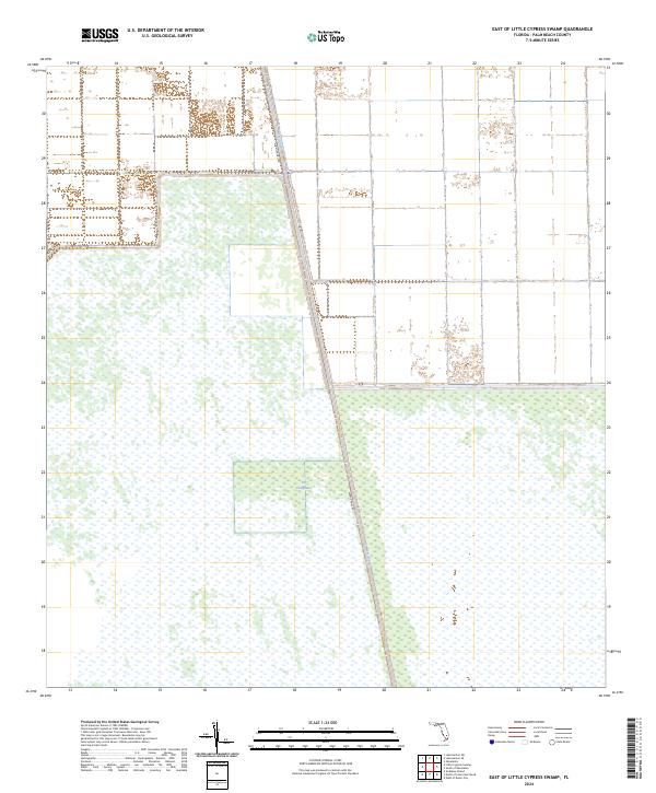
2024 Map of East of Little Cypress Swamp
USGS Topo · Published 2024About this map
The Everglades dominates the lower half of this landscape, characterized by the expansive wetland terrain that defines the southern Florida interior. The engineering of the region is centered on the Miami Canal, a primary waterway that cuts diagonally across the survey area. Parallel to this water feature is Miami Canal Rd, providing a singular corridor of transit through the surrounding marsh and agricultural tracts. The northern portion of the map displays a distinct shift toward managed land divisions and canal-fed irrigation, reflecting the ongoing transition between the protected wildlands of the glades and the intensive drainage systems required for local land use in Palm Beach County.
Find a feature on this map
8 named features on this map. Tap any name to fly to it.
Don’t see what you’re looking for? This feature index may not catch every label — zoom into the map to look around manually.
Map Details
Editions of this 2024 East of Little Cypress Swamp Map
This is the sole edition of this map. No revisions or reprints were ever made.
Other maps of this area

1956 · West Palm Beach
USGS Topo · 1:250,000

1957 · West Palm Beach
USGS Topo · 1:250,000

1958 · West Palm Beach
USGS Topo · 1:250,000

1970 · Lake Harbor SE
USGS Topo · 1:24,000

1970 · Lake Harbor SW
USGS Topo · 1:24,000

1970 · Okeelanta
USGS Topo · 1:24,000

1974 · Everglades 1 SW
USGS Topo · 1:24,000

1974 · Everglades 2 SW
USGS Topo · 1:24,000

1974 · Everglades 2 SE
USGS Topo · 1:24,000

1974 · Everglades 1 NW
USGS Topo · 1:24,000