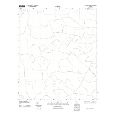
2011 Map of East of Ludowici
USGS Topo · Published 2011About this map
The South Newport River meanders through this portion of Liberty County, Georgia, defining a landscape of wetlands and timber tracts. The road network reflects the area's agricultural and industrial heritage, with long, straight stretches like Warsaw Tram Rd suggesting former logging rail corridors. Local family names are preserved in the cemetery markers at Middleton Cemetery and Branson Cemetery, while the northern reaches are drained by the slow-moving waters of Payne Creek and Sandy Run. Evidence of the region's diverse land use appears in labels like Bombing Range Rd, indicating proximity to military training grounds. The layout of rural routes such as Jonas Island Rd and Brickston Cut Off Rd provides a detailed look at the connectivity between these coastal plain settlements during the early 21st century.
Find a feature on this map
34 named features on this map. Tap any name to fly to it.
Don’t see what you’re looking for? This feature index may not catch every label — zoom into the map to look around manually.
Map Details
Editions of this 2011 East of Ludowici Map
This is the sole edition of this map. No revisions or reprints were ever made.
Other maps of this area

1918 · Hinesville
USGS Topo · 1:62,500

1920 · Sapelo River
USGS Topo · 1:62,500

1920 · Limerick
USGS Topo · 1:62,500

1943 · Ludowici
USGS Topo · 1:62,500

1943 · Sapelo River
USGS Topo · 1:62,500

1944 · Hinesville
USGS Topo · 1:62,500

1944 · Limerick
USGS Topo · 1:62,500

1945 · Sapelo River
USGS Topo · 1:62,500

1946 · Brunswick
USGS Topo · 1:250,000

1948 · Brunswick
USGS Topo · 1:250,000