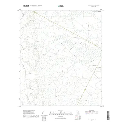
2020 Map of East of Ludowici
USGS Topo · Published 2020About this map
The coastal plains of Southeast Georgia are defined here by the winding course of the S Newport River and the expansive wetlands of Ball Town Swamp. This 2020 survey illustrates a landscape of dense pine forests and low-lying drainages, such as Payne Cr and Peacock Cr, which cross the boundaries of Liberty, Long, and McIntosh counties. The settlement of Riceboro sits at the northeastern edge of the sheet, while the interior is crisscrossed by a network of rural roads that often take their names from local families or historic landmarks, including Maybank Rd and Townsend Rd. Cultural history is anchored by sites such as Middleton Cem and Branson Cem. The presence of the Sassafrass Plantation and Thompson Hunting Club suggests a long-standing tradition of large landholdings used for agriculture and recreation in this portion of the Georgia Lowcountry.
Find a feature on this map
51 named features on this map. Tap any name to fly to it.
Don’t see what you’re looking for? This feature index may not catch every label — zoom into the map to look around manually.
Map Details
Editions of this 2020 East of Ludowici Map
This is the sole edition of this map. No revisions or reprints were ever made.
Other maps of this area

1918 · Hinesville
USGS Topo · 1:62,500

1920 · Sapelo River
USGS Topo · 1:62,500

1920 · Limerick
USGS Topo · 1:62,500

1943 · Ludowici
USGS Topo · 1:62,500

1943 · Sapelo River
USGS Topo · 1:62,500

1944 · Hinesville
USGS Topo · 1:62,500

1944 · Limerick
USGS Topo · 1:62,500

1945 · Sapelo River
USGS Topo · 1:62,500

1946 · Brunswick
USGS Topo · 1:250,000

1948 · Brunswick
USGS Topo · 1:250,000