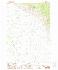
1989 Map of East of May
USGS Topo · Published 1989About this map
The Pahsimeroi Valley occupies the heart of this landscape, where the wide alluvial floor is defined by the braided path of the Pahsimeroi River. This 1989 provisional survey captures the transition from the high eastern peaks of the Challis National Forest to the productive ranching and agricultural flats of Lemhi County. The drainage pattern is the dominant organizational force here, with numerous watercourses like Morse Creek, Patterson Creek, and Falls Creek descending from the mountain front to join the primary river system. Evidence of local land use is sparse but specific, noted by a Borrow Pit and the boundary line between Lemhi Co and Custer Co. The map reveals a specialized high-desert mountain environment where water management and topographical boundaries dictated the placement of early routes and resource extraction sites.
Find a feature on this map
13 named features on this map. Tap any name to fly to it.
Don’t see what you’re looking for? This feature index may not catch every label — zoom into the map to look around manually.
Map Details
Editions of this 1989 East of May Map
This is the sole edition of this map. No revisions or reprints were ever made.
Other maps of this area

1935 · Borah Peak
USGS Topo · 1:125,000

1938 · Borah Peak
USGS Topo · 1:125,000

1955 · Dubois
USGS Topo · 1:250,000

1956 · Patterson
USGS Topo · 1:62,500

1956 · Donkey Hills
USGS Topo · 1:62,500

1956 · Doublespring
USGS Topo · 1:62,500

1956 · May
USGS Topo · 1:62,500

1958 · Dubois
USGS Topo · 1:250,000

1980 · Leadore
USGS Topo · 1:100,000
1989 · May
USGS Topo · 1:24,000