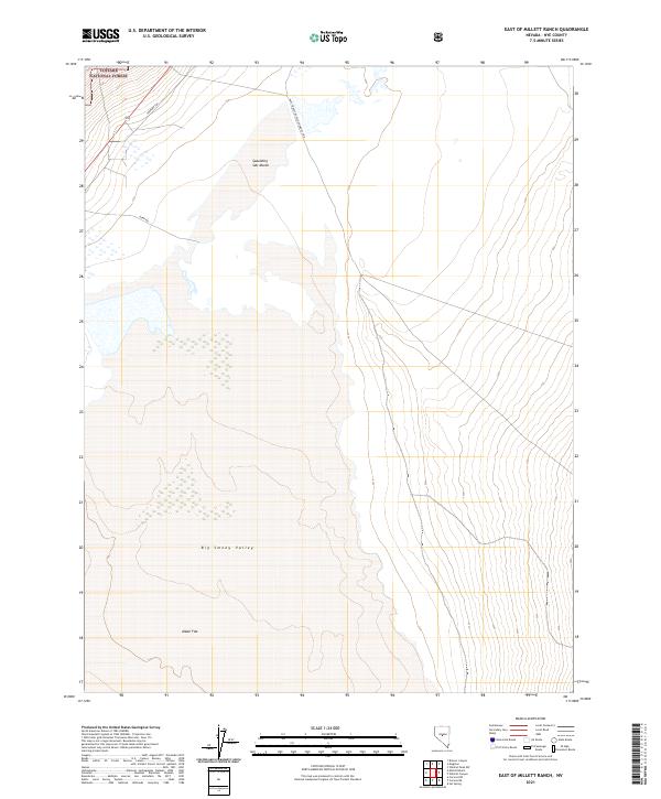
2021 Map of East of Millett Ranch
USGS Topo · Published 2021About this map
Big Smoky Valley dominates this arid landscape in Nye County, where the desert floor transitions from the Alkali Flat in the south to the significant seasonal moisture of the Spaulding Salt Marsh. This region of Nevada is characterized by expansive public lands and natural drainage patterns that define the valley floor. To the northwest, the boundary of the Toiyabe National Forest indicates the beginning of higher, protected elevations, while the valley itself is divided into numerous land parcels.
Find a feature on this map
27 named features on this map. Tap any name to fly to it.
Don’t see what you’re looking for? This feature index may not catch every label — zoom into the map to look around manually.
Map Details
Editions of this 2021 East of Millett Ranch Map
This is the sole edition of this map. No revisions or reprints were ever made.
Other maps of this area

1907 · Tonopah
USGS Topo · 1:250,000

1908 · Tonopah
USGS Topo · 1:250,000

1926 · Roberts Mountains
USGS Topo · 1:250,000

1929 · Roberts Mountains
USGS Topo · 1:250,000

1955 · Millett
USGS Topo · 1:250,000

1956 · Millett Ranch
USGS Topo · 1:62,500

1956 · Tonopah
USGS Topo · 1:250,000

1959 · Tonopah
USGS Topo · 1:250,000

1959 · Millett
USGS Topo · 1:250,000

1960 · Wildcat Peak
USGS Topo · 1:62,500