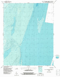
1964 Map of East of New Point Comfort
USGS Topo · Published 1987About this map
Chesapeake Bay waters dominate this bathymetric-topographic study, which focuses on the vital maritime approach to the York Spit Channel. Produced through the cooperation of the National Ocean Service and the Geological Survey, the map provides detailed soundings and underwater contours across the New Pt Comfort Shoal. A single Light stands as a navigational aid in the western waters, marking the transition from the shoals to deeper bay channels. The presence of a designated Disposal Area in the northeast quadrant reflects the active management of these shipping lanes in the mid-1960s. This sheet is primarily a maritime record, detailing the seafloor topography and depth gradients essential for navigating the entrance to the York River.
Find a feature on this map
5 named features on this map. Tap any name to fly to it.
Don’t see what you’re looking for? This feature index may not catch every label — zoom into the map to look around manually.
Map Details
Editions of this 1964 East of New Point Comfort Map
This is the sole edition of this map. No revisions or reprints were ever made.
Other maps of this area

1907 · Hampton
USGS Topo · 1:62,500

1916 · Mathews
USGS Topo · 1:62,500

1917 · Mathews
USGS Topo · 1:62,500

1943 · Elliots Creek
USGS Topo · 1:25,000

1943 · Richmond
USGS Topo · 1:250,000

1944 · Messick
USGS Topo · 1:24,000

1948 · Cape Charles
USGS Topo · 1:24,000

1948 · New Point Comfort
USGS Topo · 1:24,000

1948 · Mathews
USGS Topo · 1:24,000

1949 · Richmond
USGS Topo · 1:250,000