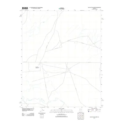
2011 Map of East of Old Leupp
USGS Topo · Published 2011About this map
The Little Colorado River winds through the southern portion of this high desert terrain, serving as a primary geographical marker for the arid landscape east of Old Leupp. The survey highlights a sparse but structured network of transportation and infrastructure within the Navajo Nation, dominated by the intersection of Indian Rte-15 and Transwestern Rd. These routes facilitate movement across a region defined by seasonal drainages like Polacca Wash. A significant industrial landmark is the Transwestern Pipeline Number Three Airport, which, along with various Indian Rte-6811 corridors, illustrates the integration of modern aviation and energy infrastructure into this ancestral geography during the early 21st century.
Find a feature on this map
9 named features on this map. Tap any name to fly to it.
Don’t see what you’re looking for? This feature index may not catch every label — zoom into the map to look around manually.
Map Details
Editions of this 2011 East of Old Leupp Map
This is the sole edition of this map. No revisions or reprints were ever made.
Other maps of this area

1883 · Tusayan
USGS Topo · 1:250,000

1886 · Tusayan
USGS Topo · 1:250,000

1947 · Flagstaff
USGS Topo · 1:250,000

1954 · Winslow
USGS Topo · 1:62,500

1954 · Winslow 4 NW
USGS Topo · 1:24,000

1954 · Flagstaff
USGS Topo · 1:250,000

1955 · Winslow 2 SW
USGS Topo · 1:24,000

1955 · Leupp
USGS Topo · 1:62,500

1957 · Winslow 1 SW
USGS Topo · 1:24,000
1957 · Winslow 2 SE
USGS Topo · 1:24,000