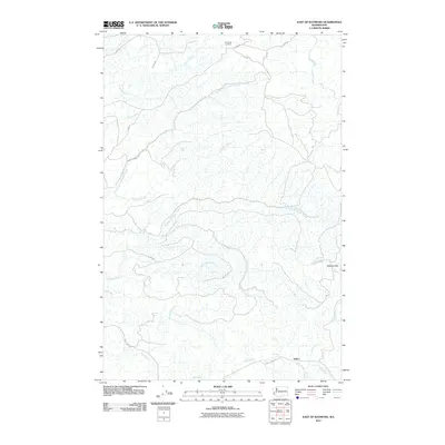
2011 Map of East of Raymond
USGS Topo · Published 2011About this map
The timber-producing landscape of the Willapa Hills dominates this 2011 survey, centered on the small settlement of Sutico in Pacific County. The terrain is defined by a dense network of logging infrastructure, where named routes like A Line Rd and G Line Rd navigate the steep ridges between deep drainage basins. High points such as Pack Sack Lookout offer a vantage over the headwaters of numerous systems, including Fairchild Creek, Wilson Creek, and Fall River. In the southern portion of the quadrangle, the valley floor opens near Mill Creek, where Mill Creek Rd provides primary access to the scattered habitations of the area. This map illustrates the intersection of industrial forestry and rural Pacific Northwest living, showing the precise paths of the creeks and tributary branches like North Fork Wilson Creek and Howe Creek as they feed the broader watershed.
Find a feature on this map
19 named features on this map. Tap any name to fly to it.
Don’t see what you’re looking for? This feature index may not catch every label — zoom into the map to look around manually.
Map Details
Editions of this 2011 East of Raymond Map
This is the sole edition of this map. No revisions or reprints were ever made.
Other maps of this area

1940 · Montesano
USGS Topo · 1:62,500

1941 · Walville
USGS Topo · 1:62,500

1941 · Ford
USGS Topo · 1:62,500

1953 · Hoquiam
USGS Topo · 1:250,000

1953 · Pe Ell
USGS Topo · 1:62,500

1953 · Malone
USGS Topo · 1:62,500

1955 · Montesano
USGS Topo · 1:62,500

1955 · Raymond
USGS Topo · 1:62,500

1957 · Hoquiam
USGS Topo · 1:250,000

1958 · Hoquiam
USGS Topo · 1:250,000