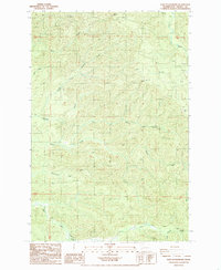
1986 Map of East of Raymond
USGS Topo · Published 1986About this map
Fall River anchors the northeastern corner of this Pacific County landscape, where a complex network of waterways defines the terrain in the mid-1980s. The drainage patterns of Ward Creek and Fairchild Creek dominate the central and northern sections, while the North Fork Fairchild Creek branches westward. This survey documents a land managed for timber and resources, evidenced by the scattered Borrow Pit excavations and the presence of a Railroad Grade winding through the southern portion of the quadrangle. The map captures the transitional period of Pacific Northwest forestry before modern digital cartography, preserving the locations of smaller drainages like Whitcomb Creek and Brown Cr as they flow through the timberlands east of the Willapa Bay coastal region.
Find a feature on this map
13 named features on this map. Tap any name to fly to it.
Don’t see what you’re looking for? This feature index may not catch every label — zoom into the map to look around manually.
Map Details
Editions of this 1986 East of Raymond Map
This is the sole edition of this map. No revisions or reprints were ever made.
Other maps of this area

1940 · Montesano
USGS Topo · 1:62,500

1941 · Walville
USGS Topo · 1:62,500

1941 · Ford
USGS Topo · 1:62,500

1953 · Hoquiam
USGS Topo · 1:250,000

1953 · Pe Ell
USGS Topo · 1:62,500

1953 · Malone
USGS Topo · 1:62,500

1955 · Montesano
USGS Topo · 1:62,500

1955 · Raymond
USGS Topo · 1:62,500

1957 · Hoquiam
USGS Topo · 1:250,000

1958 · Hoquiam
USGS Topo · 1:250,000