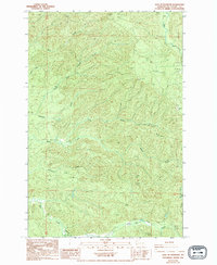
1994 Map of East of Raymond
USGS Topo · Published 1994About this map
Fall River and its complex network of tributaries define the wooded Pacific County landscape captured in this 1994 revision. The topography is dominated by deep drainage basins and prominent ridges, where waterways like Ward Creek and Fairchild Creek carve through the terrain. A notable human imprint on this landscape is The Railroad Grade, which snakes through the southern sections of the map, likely a remnant of the region's historical timber or transit operations. Several scattered Borrow Pit locations are noted throughout the hills, indicating localized extraction activities. The dense concentration of named creeks, including Wilson Creek and Mill Creek, highlights the importance of water management and natural boundaries within these forest lands, where township lines like T 14 N and T 13 N intersect.
Find a feature on this map
15 named features on this map. Tap any name to fly to it.
Don’t see what you’re looking for? This feature index may not catch every label — zoom into the map to look around manually.
Map Details
Editions of this 1994 East of Raymond Map
This is the sole edition of this map. No revisions or reprints were ever made.
Other maps of this area

1940 · Montesano
USGS Topo · 1:62,500

1941 · Walville
USGS Topo · 1:62,500

1941 · Ford
USGS Topo · 1:62,500

1953 · Hoquiam
USGS Topo · 1:250,000

1953 · Pe Ell
USGS Topo · 1:62,500

1953 · Malone
USGS Topo · 1:62,500

1955 · Montesano
USGS Topo · 1:62,500

1955 · Raymond
USGS Topo · 1:62,500

1957 · Hoquiam
USGS Topo · 1:250,000

1958 · Hoquiam
USGS Topo · 1:250,000