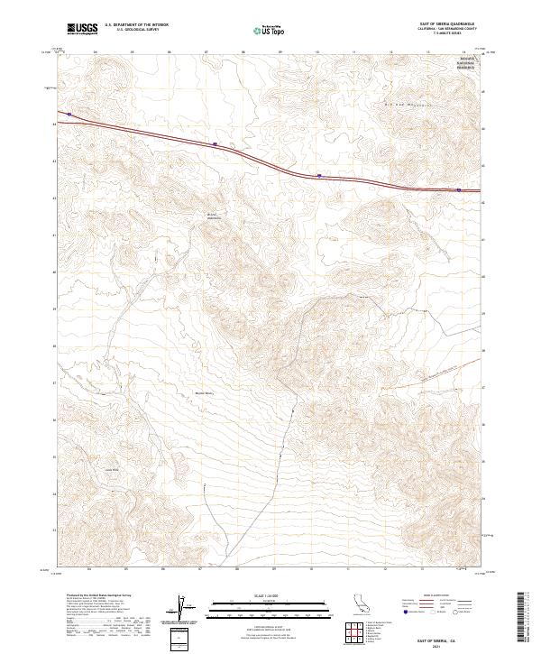
2021 Map of East of Siberia
USGS Topo · Published 2021About this map
The Mojave National Preserve covers the northeastern corner of this desert landscape, where the jagged peaks of the Old Dad Mountains meet the high arid plains. This region is defined by its extreme isolation and dramatic geological transitions, notably where the Bristol Mountains descend toward the central Mojave Desert floor. In the southwestern reaches, the Lava Hills represent ancient volcanic activity, their dark terrain contrasting with the surrounding alluvial fans. Infrastructure is nearly non-existent across these townships, with the exception of the Ns203: Needles To Ludlow Truck Trl, a rugged backcountry route that traces the historical movement through this corner of San Bernardino County. The map provides a detailed view of the Public Land Survey System grid, including t8n r11e, illustrating the vast, uninhabited stretches of the California desert as they remained in the early 21st century.
Find a feature on this map
12 named features on this map. Tap any name to fly to it.
Don’t see what you’re looking for? This feature index may not catch every label — zoom into the map to look around manually.
Map Details
Editions of this 2021 East of Siberia Map
This is the sole edition of this map. No revisions or reprints were ever made.
Other maps of this area

1942 · Amboy
USGS Topo · 1:250,000

1943 · Amboy
USGS Topo · 1:250,000

1954 · Needles
USGS Topo · 1:250,000

1954 · Amboy Crater
USGS Topo · 1:24,000

1954 · Bagdad SW
USGS Topo · 1:24,000

1956 · Needles
USGS Topo · 1:250,000

1956 · Cadiz
USGS Topo · 1:62,500
1956 · Bagdad
USGS Topo · 1:62,500

1956 · Flynn
USGS Topo · 1:62,500
1957 · Kerens
USGS Topo · 1:62,500