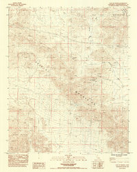
1985 Map of East of Siberia
USGS Topo · Published 1985About this map
Mining and infrastructure define this arid landscape within the East Mojave National Scenic Area. The terrain is dominated by the Bristol Mountains and the Old Dad Mountains, which are dissected by numerous prospects and established sites such as the Lady Lou Mine and the Orange Blossom Mine. These workings indicate a period of intense mineral exploration, supported by industrial features like a Pipeline and a Pumping Station located south of the mountain ridges.
Find a feature on this map
16 named features on this map. Tap any name to fly to it.
Don’t see what you’re looking for? This feature index may not catch every label — zoom into the map to look around manually.
Map Details
Editions of this 1985 East of Siberia Map
This is the sole edition of this map. No revisions or reprints were ever made.
Other maps of this area

1942 · Amboy
USGS Topo · 1:250,000

1943 · Amboy
USGS Topo · 1:250,000

1954 · Needles
USGS Topo · 1:250,000

1954 · Amboy Crater
USGS Topo · 1:24,000

1954 · Bagdad SW
USGS Topo · 1:24,000

1956 · Needles
USGS Topo · 1:250,000

1956 · Cadiz
USGS Topo · 1:62,500
1956 · Bagdad
USGS Topo · 1:62,500

1956 · Flynn
USGS Topo · 1:62,500
1957 · Kerens
USGS Topo · 1:62,500