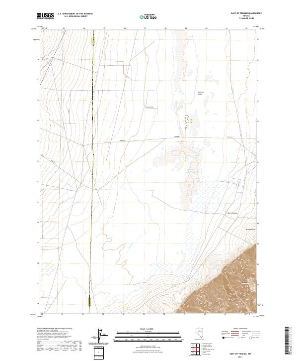
2021 Map of East of Tenabo
USGS Topo · Published 2021About this map
The boundary between Lander and Eureka counties divides this basin-and-range landscape, where the flat expanse of Crescent Valley meets the rising terrain of the Cortez Mountains. This 2021 survey documents a remote corner of Nevada where ephemeral waterways like Indian Cr, Cooks Cr, and Cottonwood Cr drain from the high ground toward the valley floor. The geography is defined by its drainage patterns, with Brock Canyon carving through the slopes on the eastern edge of the sheet.
Find a feature on this map
15 named features on this map. Tap any name to fly to it.
Don’t see what you’re looking for? This feature index may not catch every label — zoom into the map to look around manually.
Map Details
Editions of this 2021 East of Tenabo Map
This is the sole edition of this map. No revisions or reprints were ever made.
Other maps of this area

1938 · Cortez
USGS Topo · 1:48,000

1944 · Cortez
USGS Topo · 1:62,500

1949 · Crescent Valley
USGS Topo · 1:62,500

1950 · Crescent Valley
USGS Topo · 1:62,500

1955 · Winnemucca
USGS Topo · 1:250,000

1957 · Frenchie Creek
USGS Topo · 1:62,500

1957 · Horse Creek Valley
USGS Topo · 1:62,500

1958 · Winnemucca
USGS Topo · 1:250,000

1962 · Winnemucca
USGS Topo · 1:250,000
1985 · Hand-Me-Down Creek
USGS Topo · 1:24,000