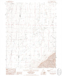
1985 Map of East of Tenabo
USGS Topo · Published 1986About this map
Crescent Valley dominates this mid-1980s landscape, where the flat basin floor is defined by a series of Alkali Flats and scattered hydrological features. Life in this arid portion of the Great Basin centers on the Dean Ranch and several Flowing Wells that dot the valley floor, providing essential water sources between the high country and the flats. To the southeast, the terrain rises sharply into the Cortez Mountains, marked by the steep descent of Brook Canyon.
Find a feature on this map
20 named features on this map. Tap any name to fly to it.
Don’t see what you’re looking for? This feature index may not catch every label — zoom into the map to look around manually.
Map Details
Editions of this 1985 East of Tenabo Map
This is the sole edition of this map. No revisions or reprints were ever made.
Other maps of this area

1938 · Cortez
USGS Topo · 1:48,000

1944 · Cortez
USGS Topo · 1:62,500

1949 · Crescent Valley
USGS Topo · 1:62,500

1950 · Crescent Valley
USGS Topo · 1:62,500

1955 · Winnemucca
USGS Topo · 1:250,000

1957 · Frenchie Creek
USGS Topo · 1:62,500

1957 · Horse Creek Valley
USGS Topo · 1:62,500

1958 · Winnemucca
USGS Topo · 1:250,000

1962 · Winnemucca
USGS Topo · 1:250,000
1985 · Hand-Me-Down Creek
USGS Topo · 1:24,000