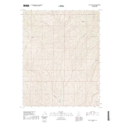
2023 Map of East of the Navajo
USGS Topo · Published 2023About this map
Kaiparowits Plateau dominates this high-altitude landscape in Kane County, Utah, where a complex network of deeply incised drainage systems defines the terrain. The map details the transition from the prominent heights of Fiftymile Mountain and West-End Point down through a series of named dry washes and canyons, including Rogers Canyon, Basin Canyon, and Monday Canyon. The southern extent of the sheet focuses on the Burning Hills and the winding course of Navajo Canyon as it approaches Little Valley.
Find a feature on this map
14 named features on this map. Tap any name to fly to it.
Don’t see what you’re looking for? This feature index may not catch every label — zoom into the map to look around manually.
Map Details
Editions of this 2023 East of the Navajo Map
This is the sole edition of this map. No revisions or reprints were ever made.
Other maps of this area

1886 · Escalante
USGS Topo · 1:250,000

1922 · Warm Creek
USGS Topo · 1:63,360

1922 · Rees Canyon
USGS Topo · 1:63,360

1953 · Cummings Mesa
USGS Topo · 1:62,500

1953 · Gunsight Butte
USGS Topo · 1:62,500

1956 · Escalante
USGS Topo · 1:250,000

1960 · Escalante
USGS Topo · 1:250,000

1968 · East of The Navajo
USGS Topo · 1:24,000
1968 · Collet Top
USGS Topo · 1:24,000
1968 · Big Hollow Wash
USGS Topo · 1:24,000