1987 Map of East of Tonopah
USGS Topo · Published 1987About this map
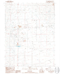
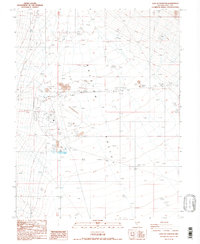
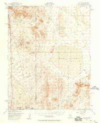
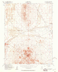
Ralston Valley dominates this 1980s landscape east of the mining hub of Tonopah, revealing a transitional zone between industrial utility and open desert. This period of development is marked by the presence of the Tonopah Airport and a nearby Trailer Park, indicating the growth of infrastructure in this corner of Nye County. The map provides a unique look at local industry through numerous Gravel Pits and a Borrow Pit, features often sought by those tracing changes in the region's land use.
Find a feature on this map
16 named features on this map. Tap any name to fly to it.
Don’t see what you’re looking for? This feature index may not catch every label — zoom into the map to look around manually.
Map Details
Editions of this 1987 East of Tonopah Map
2 editions found
Other maps of this area

1907 · Tonopah
USGS Topo · 1:250,000

1908 · Kawich
USGS Topo · 1:250,000

1908 · Lida
USGS Topo · 1:250,000

1908 · Tonopah
USGS Topo · 1:250,000

1913 · Lida
USGS Topo · 1:250,000
1942 · Cactus Range
USGS Topo · 1:125,000
1945 · Goldfield
USGS Topo · 1:125,000
1952 · Mud Lake
USGS Topo · 1:62,500
1952 · Cactus Peak
USGS Topo · 1:62,500

1954 · Goldfield
USGS Topo · 1:250,000