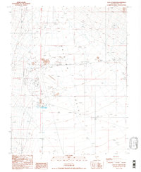
1987 Map of East of Tonopah
USGS Topo · Published 1987About this map
Ralston Valley dominates this 1980s landscape, serving as a hub for regional aviation and industrial activity. The massive Tonopah Airport footprint occupies a central position, defined by a clearly marked Airport Boundary and supported by infrastructure such as tanks and a dedicated Radio Facility. The map captures the utility-driven nature of the area during this era, showing the expansion of local resources through numerous Borrow Pits, Gravel Pits, and Dikes near the Sewage Disposal Ponds.
Find a feature on this map
16 named features on this map. Tap any name to fly to it.
Don’t see what you’re looking for? This feature index may not catch every label — zoom into the map to look around manually.
Map Details
Editions of this 1987 East of Tonopah Map
2 editions found
Other maps of this area

1907 · Tonopah
USGS Topo · 1:250,000

1908 · Kawich
USGS Topo · 1:250,000

1908 · Lida
USGS Topo · 1:250,000

1908 · Tonopah
USGS Topo · 1:250,000

1913 · Lida
USGS Topo · 1:250,000

1942 · Cactus Range
USGS Topo · 1:125,000

1945 · Goldfield
USGS Topo · 1:125,000

1952 · Mud Lake
USGS Topo · 1:62,500

1952 · Cactus Peak
USGS Topo · 1:62,500

1954 · Goldfield
USGS Topo · 1:250,000