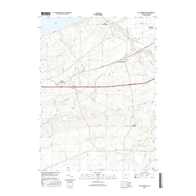
2016 Map of East Springfield
USGS Topo · Published 2016About this map
Lake Erie defines the northern edge of this Erie County survey, where the shoreline and coastal bluffs give way to a network of creeks and agricultural plateaus. The historic east-west corridor of Ridge Rd connects the primary settlements of East Springfield and West Springfield, following a natural geographic rise that has dictated travel through the region for generations. To the northeast, the rail-oriented legacy of Thornton Junction remains visible near the winding path of Crooked Creek.
Find a feature on this map
73 named features on this map. Tap any name to fly to it.
Don’t see what you’re looking for? This feature index may not catch every label — zoom into the map to look around manually.
Map Details
Editions of this 2016 East Springfield Map
This is the sole edition of this map. No revisions or reprints were ever made.
Other maps of this area

1900 · Girard
USGS Topo · 1:62,500

1900 · Fairview
USGS Topo · 1:62,500

1906 · Conneaut
USGS Topo · 1:62,500

1950 · Cleveland
USGS Topo · 1:250,000

1950 · Erie
USGS Topo · 1:250,000

1956 · Cleveland
USGS Topo · 1:250,000

1957 · Fairview SW
USGS Topo · 1:24,000
1957 · Fairview
USGS Topo · 1:24,000

1959 · Conneautville
USGS Topo · 1:24,000

1959 · East Springfield
USGS Topo · 1:24,000