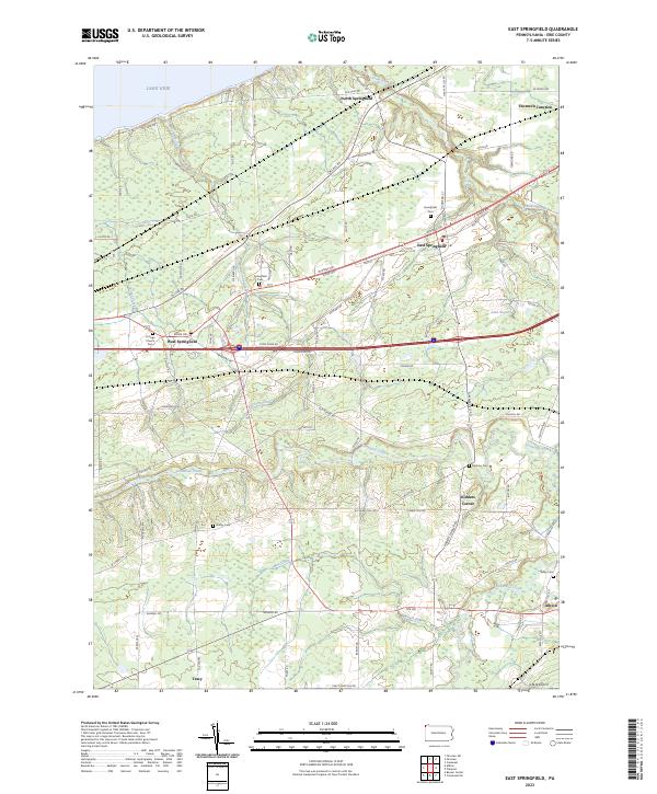
2023 Map of East Springfield
USGS Topo · Published 2023About this map
Lake Erie shoreline and the low-lying glacial plains of western Erie County define this portrait of the Springfield area. The map illustrates a distinctive settlement pattern concentrated along the historic ridge roads, particularly W Ridge Rd and Main St, which serve as the primary east-west arteries for West Springfield, East Springfield, and North Springfield. The landscape is intricately carved by several major waterways flowing north toward the lake, including the winding paths of Raccoon Creek, Crooked Creek, and the larger Conneaut Creek in the south. Genealogists will find a cluster of burial grounds across the townships, from the Springfield Cem near the town centers to the smaller Griffey Cem and Salsbury Cem further south. The southern portion of the sheet reveals a transition into more rolling terrain near Albion, where Marsh Run feeds into the local drainage system near the Valley Cem.
Find a feature on this map
83 named features on this map. Tap any name to fly to it.
Don’t see what you’re looking for? This feature index may not catch every label — zoom into the map to look around manually.
Map Details
Editions of this 2023 East Springfield Map
This is the sole edition of this map. No revisions or reprints were ever made.
Other maps of this area

1900 · Girard
USGS Topo · 1:62,500

1900 · Fairview
USGS Topo · 1:62,500

1906 · Conneaut
USGS Topo · 1:62,500

1950 · Cleveland
USGS Topo · 1:250,000

1950 · Erie
USGS Topo · 1:250,000

1956 · Cleveland
USGS Topo · 1:250,000

1957 · Fairview SW
USGS Topo · 1:24,000
1957 · Fairview
USGS Topo · 1:24,000

1959 · Conneautville
USGS Topo · 1:24,000

1959 · East Springfield
USGS Topo · 1:24,000