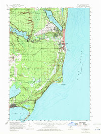
1959 Map of East Tawas
USGS Topo · Published 1972About this map
Wurtsmith Air Force Base dominates the northern reaches of the Iosco County shoreline, representing a period of significant military presence along the Lake Huron coast. This 1959 survey documents the landscape just as the base was becoming a central fixture of the region, positioned between the waters of Van Etten Lake and the Au Sable River. To the south, the twin communities of Oscoda and Au Sable sit at the river mouth, while East Tawas anchors the curve of Tawas Bay.
Find a feature on this map
48 named features on this map. Tap any name to fly to it.
Don’t see what you’re looking for? This feature index may not catch every label — zoom into the map to look around manually.
Map Details
Editions of this 1959 East Tawas Map
3 editions found
Other maps of this area

1954 · Tawas City
USGS Topo · 1:250,000

1958 · Tawas City
USGS Topo · 1:250,000

1959 · Tawas City
USGS Topo · 1:62,500

1959 · East Tawas
USGS Topo · 1:62,500

1959 · Glennie
USGS Topo · 1:62,500

1959 · Harrisville
USGS Topo · 1:62,500

1966 · Alabaster
USGS Topo · 1:24,000

1983 · Hubbard Lake
USGS Topo · 1:100,000

1984 · Tawas City
USGS Topo · 1:100,000

1989 · Mikado
USGS Topo · 1:24,000