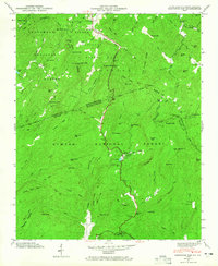
1946 Map of Eastatoe Gap
USGS Topo · Published 1965About this map
Sassafras Mtn and the surrounding high-elevation peaks of the Blue Ridge dominate this 1946 study by the Tennessee Valley Authority. This topographic record documents the complex drainage patterns where the Toxaway River and Eastatoe Creek carve through three national forests, including the Nantahala National Forest and Pisgah National Forest. The map captures a high-altitude landscape of ridges and gaps before significant modern development, emphasizing the isolation of small mountain clearings.
Find a feature on this map
88 named features on this map. Tap any name to fly to it.
Don’t see what you’re looking for? This feature index may not catch every label — zoom into the map to look around manually.
Map Details
Editions of this 1946 Eastatoe Gap Map
4 editions found
Other maps of this area

1888 · Pickens
USGS Topo · 1:125,000

1894 · Pickens
USGS Topo · 1:125,000

1905 · Pisgah
USGS Topo · 1:125,000

1906 · Pisgah
USGS Topo · 1:125,000

1935 · Brevard
USGS Topo · 1:24,000

1935 · Eastatoe Gap
USGS Topo · 1:24,000

1935 · Rosman
USGS Topo · 1:24,000

1935 · Lake Toxaway
USGS Topo · 1:24,000

1935 · Reid
USGS Topo · 1:24,000

1935 · Table Rock
USGS Topo · 1:24,000