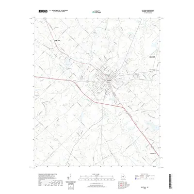
2020 Map of Eastman
USGS Topo · Published 2020About this map
The Dodge County Courthouse stands as the central landmark of Eastman, Georgia, anchoring a community where civil administration and regional infrastructure meet. This contemporary survey shows a landscape defined by its transit corridors and public institutions, including the campus of Middle Georgia State University - Eastman and the Heart of Georgia Regional Airport. Outside the primary settlement, the terrain is shaped by the winding course of Sugar Cr and Crooked Br, with smaller settlements like Dodge High to the northwest and Godwinsville to the southeast.
Find a feature on this map
153 named features on this map. Tap any name to fly to it.
Don’t see what you’re looking for? This feature index may not catch every label — zoom into the map to look around manually.
Map Details
Editions of this 2020 Eastman Map
This is the sole edition of this map. No revisions or reprints were ever made.
Other maps of this area

1956 · Cochran
USGS Topo · 1:62,500

1957 · Macon
USGS Topo · 1:250,000

1958 · Macon
USGS Topo · 1:250,000

1964 · Macon
USGS Topo · 1:250,000

1972 · Eastman
USGS Topo · 1:24,000

1972 · West Of Eastman
USGS Topo · 1:24,000

1972 · Jay Bird Springs
USGS Topo · 1:24,000

1972 · Abbeville North
USGS Topo · 1:24,000
1972 · Milan
USGS Topo · 1:24,000

1972 · Lake Cypress
USGS Topo · 1:24,000