2022 Map of Easton
USGS Topo · Published 2022About this map
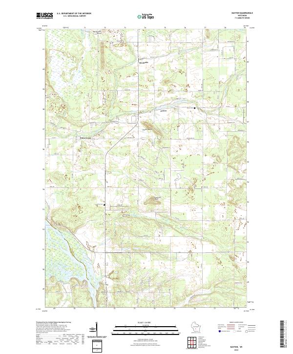
The Wisconsin River carves the southwestern boundary of this Adams County landscape, where the settlements of Easton and White Creek anchor a predominantly rural and wooded terrain. Prominent glacial and geological features define the topography, most notably the distinct elevation of Easton Mound and Rattlesnake Mound, alongside the steep rise of Anderson Bluff. The area's water network is intricately detailed, showing Campbell Creek and Fairbanks Cr feeding into the lowlands near Grays Marsh. Local history is preserved through the locations of the Easton Cem and Townline Cem, which provide valuable points of reference for genealogists. The map also captures the grid of county roads and local avenues, such as Co RD A and Edgewood Dr, that facilitate movement between small clusters like Brookside and the surrounding farmland and riverfront.
Find a feature on this map
70 named features on this map. Tap any name to fly to it.
Don’t see what you’re looking for? This feature index may not catch every label — zoom into the map to look around manually.
Map Details
Editions of this 2022 Easton Map
This is the sole edition of this map. No revisions or reprints were ever made.