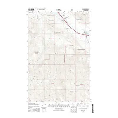
2014 Map of Easton
USGS Topo · Published 2014About this map
Easton serves as a central hub within the Wenatchee National Forest, where the upper Yakima River valley transitions into the steep terrain of the Cascades. This 2014 survey captures a landscape defined by its water and transportation corridors, featuring Lake Easton and the smaller Lavender Lake to the southeast. The settlement pattern is concentrated along the river and rail path, with Hubner to the northwest and Pine Glen near the eastern boundary.
Find a feature on this map
40 named features on this map. Tap any name to fly to it.
Don’t see what you’re looking for? This feature index may not catch every label — zoom into the map to look around manually.
Map Details
Editions of this 2014 Easton Map
This is the sole edition of this map. No revisions or reprints were ever made.
Other maps of this area

1901 · Snoqualmie Pass
USGS Topo · 1:125,000

1903 · Snoqualmie
USGS Topo · 1:125,000

1957 · Wenatchee
USGS Topo · 1:250,000

1961 · Snoqualmie Pass
USGS Topo · 1:62,500

1961 · Easton
USGS Topo · 1:62,500

1961 · Kachess Lake
USGS Topo · 1:62,500

1962 · Lester
USGS Topo · 1:62,500

1975 · Snoqualmie Pass
USGS Topo · 1:100,000

1989 · Easton
USGS Topo · 1:24,000
1989 · Raven Roost
USGS Topo · 1:24,000