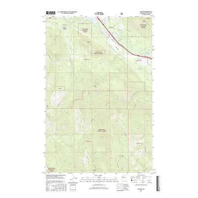
2017 Map of Easton
USGS Topo · Published 2017About this map
Easton sits at the northern edge of this high-elevation landscape where the Yakima River flows into Lake Easton. The terrain is defined by dramatic ridgelines and summits including Easton Ridge, Monahan Mtn, and the high point of Goat Peak. This territory is heavily managed for recreation and conservation, split between the Wenatchee National Forest and Snoqualmie National Forest.
Find a feature on this map
53 named features on this map. Tap any name to fly to it.
Don’t see what you’re looking for? This feature index may not catch every label — zoom into the map to look around manually.
Map Details
Editions of this 2017 Easton Map
This is the sole edition of this map. No revisions or reprints were ever made.
Other maps of this area

1901 · Snoqualmie Pass
USGS Topo · 1:125,000

1903 · Snoqualmie
USGS Topo · 1:125,000

1957 · Wenatchee
USGS Topo · 1:250,000

1961 · Snoqualmie Pass
USGS Topo · 1:62,500

1961 · Easton
USGS Topo · 1:62,500

1961 · Kachess Lake
USGS Topo · 1:62,500

1962 · Lester
USGS Topo · 1:62,500

1975 · Snoqualmie Pass
USGS Topo · 1:100,000

1989 · Easton
USGS Topo · 1:24,000
1989 · Raven Roost
USGS Topo · 1:24,000