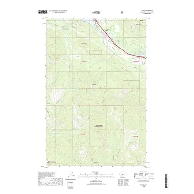
2020 Map of Easton
USGS Topo · Published 2020About this map
Easton serves as the central hub of this mountain corridor, where the Yakima River and Lake Easton dominate the local geography. The area's character is defined by its transit and water management history, featuring the Iron Horse Trl—a significant recreational route following a former rail alignment—and the Main Canal, which speaks to the hydraulic engineering of the region. The landscape transitions from the valley floor to prominent heights like Monahan Mtn and Goat Peak, while the settlement of Cabin Creek marks the westward approach toward the Cascades.
Find a feature on this map
50 named features on this map. Tap any name to fly to it.
Don’t see what you’re looking for? This feature index may not catch every label — zoom into the map to look around manually.
Map Details
Editions of this 2020 Easton Map
This is the sole edition of this map. No revisions or reprints were ever made.
Other maps of this area

1901 · Snoqualmie Pass
USGS Topo · 1:125,000

1903 · Snoqualmie
USGS Topo · 1:125,000

1957 · Wenatchee
USGS Topo · 1:250,000

1961 · Snoqualmie Pass
USGS Topo · 1:62,500

1961 · Easton
USGS Topo · 1:62,500

1961 · Kachess Lake
USGS Topo · 1:62,500

1962 · Lester
USGS Topo · 1:62,500

1975 · Snoqualmie Pass
USGS Topo · 1:100,000

1989 · Easton
USGS Topo · 1:24,000
1989 · Raven Roost
USGS Topo · 1:24,000