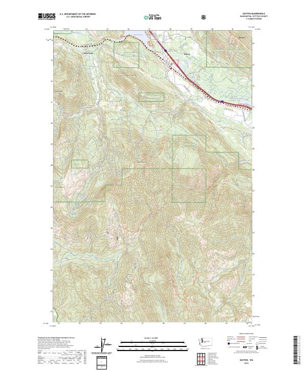
2023 Map of Easton
USGS Topo · Published 2023About this map
The settlement of Easton serves as a central hub in this high-country landscape, where the Yakima River flows through a narrow corridor alongside Lake Easton. This modern survey illustrates the complex relationship between regional water management and recreational land use, notably featuring the Main Canal and several significant lakes such as Lavender Lake. The surrounding terrain is defined by prominent peaks and ridges including Monahan Mtn, Easton Ridge, and Goat Peak, which are part of the vast Wenatchee National Forest.
Find a feature on this map
52 named features on this map. Tap any name to fly to it.
Don’t see what you’re looking for? This feature index may not catch every label — zoom into the map to look around manually.
Map Details
Editions of this 2023 Easton Map
This is the sole edition of this map. No revisions or reprints were ever made.
Other maps of this area

1901 · Snoqualmie Pass
USGS Topo · 1:125,000

1903 · Snoqualmie
USGS Topo · 1:125,000

1957 · Wenatchee
USGS Topo · 1:250,000

1961 · Snoqualmie Pass
USGS Topo · 1:62,500

1961 · Easton
USGS Topo · 1:62,500

1961 · Kachess Lake
USGS Topo · 1:62,500

1962 · Lester
USGS Topo · 1:62,500

1975 · Snoqualmie Pass
USGS Topo · 1:100,000

1989 · Easton
USGS Topo · 1:24,000
1989 · Raven Roost
USGS Topo · 1:24,000