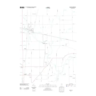
2013 Map of Eaton
USGS Topo · Published 2013About this map
The Mississinewa River winds through this section of Delaware County, anchoring a landscape defined by its agricultural heritage and specialized aviation history. The town of Eaton serves as the primary population center, situated where the river meets a grid of local roads like W Indiana Ave and N Meridian St. To the south, smaller communities such as Granville, Shideler, and Royerton mark the transition between open farmland and the growing outskirts of the region.
Find a feature on this map
90 named features on this map. Tap any name to fly to it.
Don’t see what you’re looking for? This feature index may not catch every label — zoom into the map to look around manually.
Map Details
Editions of this 2013 Eaton Map
This is the sole edition of this map. No revisions or reprints were ever made.
Other maps of this area

1952 · Muncie East
USGS Topo · 1:24,000

1952 · Farmland
USGS Topo · 1:24,000

1952 · Muncie West
USGS Topo · 1:24,000

1953 · Muncie
USGS Topo · 1:250,000

1956 · Muncie
USGS Topo · 1:250,000

1960 · Pennville
USGS Topo · 1:24,000

1960 · Hartford City East
USGS Topo · 1:24,000

1960 · Eaton
USGS Topo · 1:24,000

1960 · Wheeling
USGS Topo · 1:24,000
1960 · Redkey
USGS Topo · 1:24,000