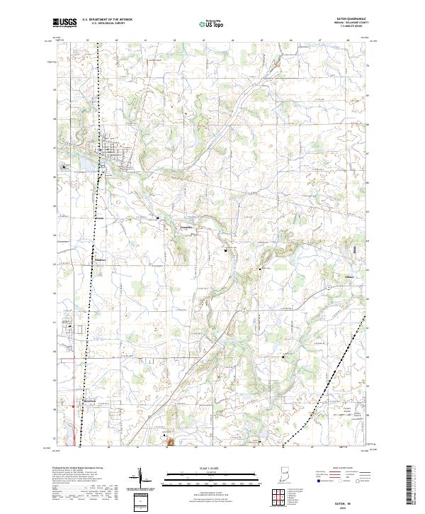
2022 Map of Eaton
USGS Topo · Published 2022About this map
The Mississinewa River carves a winding path through this portion of Delaware County, defining the agricultural and residential landscape between Eaton and Albany. This 2022 survey captures the modern layout of small Indiana communities like Shideler and Royerton, where grid-patterned streets meet the irregular drainage lines of Studebaker Ditch and Bosman Ditch. For genealogical researchers, the map provides precise locations for numerous rural burial grounds, including Gardens of Memory Cem, Black Cem, and Leaird Cem, which are scattered among the farmsteads and field boundaries.
Find a feature on this map
61 named features on this map. Tap any name to fly to it.
Don’t see what you’re looking for? This feature index may not catch every label — zoom into the map to look around manually.
Map Details
Editions of this 2022 Eaton Map
This is the sole edition of this map. No revisions or reprints were ever made.
Other maps of this area

1952 · Muncie East
USGS Topo · 1:24,000

1952 · Farmland
USGS Topo · 1:24,000

1952 · Muncie West
USGS Topo · 1:24,000

1953 · Muncie
USGS Topo · 1:250,000

1956 · Muncie
USGS Topo · 1:250,000

1960 · Pennville
USGS Topo · 1:24,000

1960 · Hartford City East
USGS Topo · 1:24,000

1960 · Eaton
USGS Topo · 1:24,000

1960 · Wheeling
USGS Topo · 1:24,000
1960 · Redkey
USGS Topo · 1:24,000