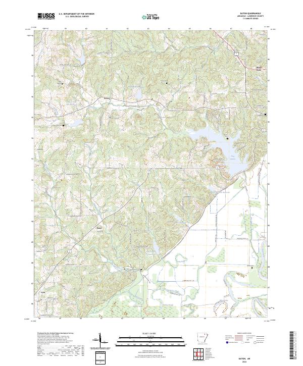
2024 Map of Eaton
USGS Topo · Published 2024About this map
The Black River winds along the eastern edge of this Lawrence County landscape, defining a low-lying region of sloughs and ponds including Sawlog Slough, Hill Slough, and White Pond. This area is characterized by a network of small settlements such as Eaton, Denton, and Lynn, which are connected by a grid of county roads. The terrain is marked by numerous water control projects, notably the series of reservoirs like Flat Cr Site Six Reservoir and Flat Cr Site Two Reservoir that manage the flow of Flat Creek as it moves toward the river basin.
Find a feature on this map
93 named features on this map. Tap any name to fly to it.
Don’t see what you’re looking for? This feature index may not catch every label — zoom into the map to look around manually.
Map Details
Editions of this 2024 Eaton Map
This is the sole edition of this map. No revisions or reprints were ever made.
Other maps of this area

1932 · Strawberry
USGS Topo · 1:62,500

1934 · Powhatan
USGS Topo · 1:62,500

1935 · Powhatan
USGS Topo · 1:62,500

1935 · Alicia
USGS Topo · 1:62,500

1935 · Strawberry
USGS Topo · 1:62,500

1941 · Strawberry
USGS Topo · 1:62,500

1953 · Memphis
USGS Topo · 1:250,000

1955 · Strawberry
USGS Topo · 1:24,000

1956 · Memphis
USGS Topo · 1:250,000

1957 · Poplar Bluff
USGS Topo · 1:250,000