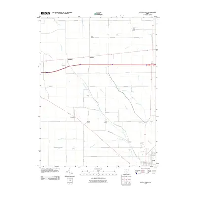
2010 Map of Eaton North
USGS Topo · Published 2010About this map
Sevenmile Creek and its many tributaries, including Bantas Fork and Periwinkle Run, carve through this agricultural section of Preble County just north of the city of Eaton. The landscape is defined by its rural density, where small historic settlements like Gettysburg and New Hope serve as local hubs for the surrounding farmsteads. Family and community heritage is deeply etched into the land, evidenced by the numerous burial grounds dispersed across the townships, such as Stump Cemetery and Petry Cemetery. A distinct transportation network of farm-to-market roads, such as Eaton Gettysburg Rd and Orphans Rd, connects these hamlets. Near the southern edge, Christman Bridge spans the water, anchoring a pocket of development that transitions toward the larger residential grid of the county seat.
Find a feature on this map
55 named features on this map. Tap any name to fly to it.
Don’t see what you’re looking for? This feature index may not catch every label — zoom into the map to look around manually.
Map Details
Editions of this 2010 Eaton North Map
This is the sole edition of this map. No revisions or reprints were ever made.
Other maps of this area

1911 · Oxford
USGS Topo · 1:62,500

1915 · New Paris
USGS Topo · 1:48,000

1915 · College Corner
USGS Topo · 1:48,000

1918 · College Corner
USGS Topo · 1:62,500

1918 · New Paris
USGS Topo · 1:62,500

1953 · Cincinnati
USGS Topo · 1:250,000

1957 · Cincinnati
USGS Topo · 1:250,000

1960 · New Madison
USGS Topo · 1:24,000

1960 · Fairhaven
USGS Topo · 1:24,000
1960 · Whitewater
USGS Topo · 1:24,000