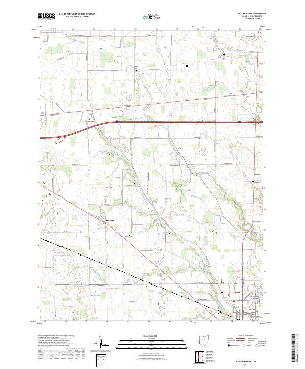
2023 Map of Eaton North
USGS Topo · Published 2023About this map
New Hope and the northern outskirts of Eaton define this portion of Preble County, where a dense network of country roads connects family farmsteads and rural landmarks. The landscape is deeply etched by a system of waterways including Sevenmile Creek, Bantas Fork, and Goose Creek, which dictated the early placement of homesteads and burial grounds. Genealogists will find this sheet particularly valuable for its high density of small family and community burial sites, from Wares Chapel Cem in the northeast to the County Home Cem near the southern boundary. These cemeteries, alongside sites like Zion Church Graveyard and New Hope Cem, trace the generational settlement patterns of the township. The historic National Rd traverses the center of the quadrangle, serving as a primary corridor for commerce and travel that shaped the growth of the surrounding agricultural community.
Find a feature on this map
80 named features on this map. Tap any name to fly to it.
Don’t see what you’re looking for? This feature index may not catch every label — zoom into the map to look around manually.
Map Details
Editions of this 2023 Eaton North Map
This is the sole edition of this map. No revisions or reprints were ever made.
Other maps of this area

1911 · Oxford
USGS Topo · 1:62,500

1915 · New Paris
USGS Topo · 1:48,000

1915 · College Corner
USGS Topo · 1:48,000

1918 · College Corner
USGS Topo · 1:62,500

1918 · New Paris
USGS Topo · 1:62,500

1953 · Cincinnati
USGS Topo · 1:250,000

1957 · Cincinnati
USGS Topo · 1:250,000

1960 · New Madison
USGS Topo · 1:24,000

1960 · Fairhaven
USGS Topo · 1:24,000
1960 · Whitewater
USGS Topo · 1:24,000