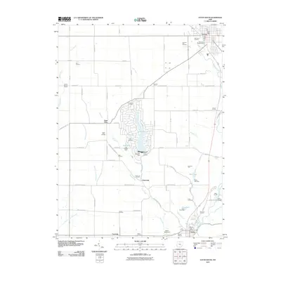
2010 Map of Eaton South
USGS Topo · Published 2010About this map
Sevenmile Creek and Paint Creek anchor the landscape of this Preble County region, where the city of Eaton sits at the northern edge. The map captures a transition from urban center to rural agricultural land, punctuated by the residential developments surrounding Lake Lakengren and Thor Lake. The presence of numerous small cemeteries, such as Friendship Cemetery, Muttonville Cemetery, and Gard Cemetery, provides significant data for genealogists tracing family histories in the township.
Find a feature on this map
80 named features on this map. Tap any name to fly to it.
Don’t see what you’re looking for? This feature index may not catch every label — zoom into the map to look around manually.
Map Details
Editions of this 2010 Eaton South Map
This is the sole edition of this map. No revisions or reprints were ever made.
Other maps of this area

1911 · Oxford
USGS Topo · 1:62,500

1915 · New Paris
USGS Topo · 1:48,000

1915 · College Corner
USGS Topo · 1:48,000

1918 · College Corner
USGS Topo · 1:62,500

1918 · New Paris
USGS Topo · 1:62,500

1953 · Cincinnati
USGS Topo · 1:250,000

1957 · Cincinnati
USGS Topo · 1:250,000

1960 · Fairhaven
USGS Topo · 1:24,000
1960 · New Paris
USGS Topo · 1:24,000
1960 · College Corner
USGS Topo · 1:24,000