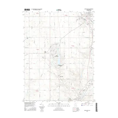
2016 Map of Eaton South
USGS Topo · Published 2016About this map
Eaton and Camden anchor this survey of central Preble County, where the landscape is defined by the drainage systems of Sevenmile Creek and Paint Creek. The map documents a high density of small family and community burial grounds, including the Mound Hill Cem and Fort Saint Clair Cem near the northern edge, as well as the Friendship Cem and Sugar Valley Cem further south.
Find a feature on this map
71 named features on this map. Tap any name to fly to it.
Don’t see what you’re looking for? This feature index may not catch every label — zoom into the map to look around manually.
Map Details
Editions of this 2016 Eaton South Map
This is the sole edition of this map. No revisions or reprints were ever made.
Other maps of this area

1911 · Oxford
USGS Topo · 1:62,500

1915 · New Paris
USGS Topo · 1:48,000

1915 · College Corner
USGS Topo · 1:48,000

1918 · College Corner
USGS Topo · 1:62,500

1918 · New Paris
USGS Topo · 1:62,500

1953 · Cincinnati
USGS Topo · 1:250,000

1957 · Cincinnati
USGS Topo · 1:250,000

1960 · Fairhaven
USGS Topo · 1:24,000
1960 · New Paris
USGS Topo · 1:24,000
1960 · College Corner
USGS Topo · 1:24,000