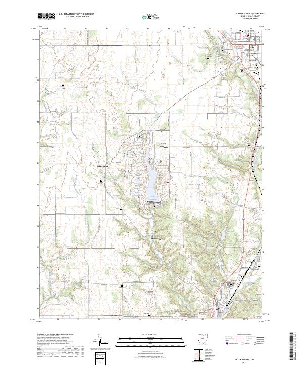
2023 Map of Eaton South
USGS Topo · Published 2023About this map
Eaton and Camden anchor this survey of central Preble County, where the landscape transitions from the residential streets around the Preble County Courthouse to the complex hydrography of the Sevenmile Creek and Paint Creek basins. The area is dense with historical burial grounds, including the prominent Mound Hill Cem and Fort Saint Clair Cem near the northern border, alongside family plots like Gard Cem and Pottenger Cem. Modern development is most visible around Lake Lakengren, a large reservoir system featuring specialized basins like Thor Lake and Lake Valhalla. Significant elevation changes are noted at the Devils Backbone along the southern edge, while agricultural infrastructure and small airstrips like Mite Airport speak to the region's rural character.
Find a feature on this map
119 named features on this map. Tap any name to fly to it.
Don’t see what you’re looking for? This feature index may not catch every label — zoom into the map to look around manually.
Map Details
Editions of this 2023 Eaton South Map
This is the sole edition of this map. No revisions or reprints were ever made.
Other maps of this area

1911 · Oxford
USGS Topo · 1:62,500

1915 · New Paris
USGS Topo · 1:48,000

1915 · College Corner
USGS Topo · 1:48,000

1918 · College Corner
USGS Topo · 1:62,500

1918 · New Paris
USGS Topo · 1:62,500

1953 · Cincinnati
USGS Topo · 1:250,000

1957 · Cincinnati
USGS Topo · 1:250,000

1960 · Fairhaven
USGS Topo · 1:24,000
1960 · New Paris
USGS Topo · 1:24,000
1960 · College Corner
USGS Topo · 1:24,000