2023 Map of Eau Claire
USGS Topo · Published 2023About this map
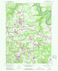
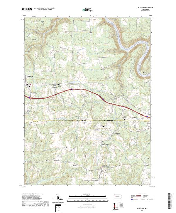
The Allegheny Wild and Scenic River curves through the northeastern corner of this landscape, marking a terrain defined by the deep valleys of Scrubgrass Creek and its many branches. This region, straddling the line between Venango and Butler counties, centers on the borough of Eau Claire and the town of Clintonville. The settlement pattern reflects a long history of rural community life, with numerous small junctions such as Riddle Crossroads, Smith Corners, and Crawford Corners serving as local landmarks. The drainage of the South Fork Little Scrubgrass Creek and North Fork Little Scrubgrass Creek provides a natural framework for the scattered farmsteads and family cemeteries like Calvert Riddle Cem and McKee Cem. Historic infrastructure is evident in the naming of Sutton Mill and Sedwicks Mill, suggesting the local water-powered industry that once supported these upland communities.
Find a feature on this map
118 named features on this map. Tap any name to fly to it.
Don’t see what you’re looking for? This feature index may not catch every label — zoom into the map to look around manually.
Map Details
Editions of this 2023 Eau Claire Map
This is the sole edition of this map. No revisions or reprints were ever made.