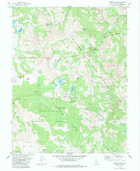
1979 Map of Ebbetts Pass
USGS Topo · Published 1984About this map
Mining operations and high-altitude water resources dominate this portion of Alpine County, where the borders of the Eldorado National Forest, Toiyabe National Forest, and Stanislaus National Forest converge. The landscape is marked by the legacy of silver extraction, centered around the Silver Mtn (Site) and numerous underground workings like the Lady Franklin Mine, Exchequer Mine, and the Pennsylvania Mine. These sites sit amidst a complex network of peaks and canyons, including Ebbetts Pass and Noble Canyon, which have long served as vital transit corridors through the Sierra Nevada.
Find a feature on this map
65 named features on this map. Tap any name to fly to it.
Don’t see what you’re looking for? This feature index may not catch every label — zoom into the map to look around manually.
Map Details
Editions of this 1979 Ebbetts Pass Map
4 editions found
Other maps of this area

1889 · Markleeville
USGS Topo · 1:125,000

1891 · Markleeville
USGS Topo · 1:125,000

1893 · Markleeville
USGS Topo · 1:125,000

1896 · Dardanelles
USGS Topo · 1:125,000

1898 · Dardanelles
USGS Topo · 1:125,000

1948 · Walker Lake
USGS Topo · 1:250,000

1956 · Topaz Lake
USGS Topo · 1:62,500

1956 · Markleeville
USGS Topo · 1:62,500

1956 · Dardanelles Cone
USGS Topo · 1:62,500

1956 · Sonora Pass
USGS Topo · 1:62,500