
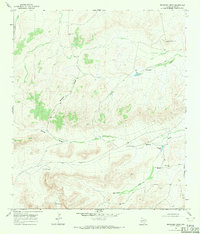
1968 Map of Ebers Camp
USGS Topo · Published 1971About this map
The Goat Hills dominate this portion of Pecos County, defining a landscape shaped by intermittent drainage systems and the necessity of groundwater for ranching. In the late 1960s, the area relied on a network of named water sources like Carlos Tank and Shelton Tank to sustain operations at outposts such as North Camp and Ebers Camp. The terrain is characterized by deep erosional features including Burnen Canyon and Big Canyon, which funnel runoff into major draws like Monument Draw. Land management and property boundaries are evidenced by the placement of family-named or numbered landmarks, such as the Hess Windmill and Crawford Windmills. The presence of the Big Divide in the southeast indicates the high ground separating these drainage basins, serving as a critical topographical boundary in this arid environment.
Find a feature on this map
30 named features on this map. Tap any name to fly to it.
Don’t see what you’re looking for? This feature index may not catch every label — zoom into the map to look around manually.
Map Details
Editions of this 1968 Ebers Camp Map
This is the sole edition of this map. No revisions or reprints were ever made.
Other maps of this area

1920 · Longfellow
USGS Topo · 1:125,000

1923 · Sierra Madera
USGS Topo · 1:62,500

1928 · Comanche Spring
USGS Topo · 1:125,000

1954 · Fort Stockton
USGS Topo · 1:250,000

1958 · Fort Stockton
USGS Topo · 1:250,000

1968 · Cap Rock Butte
USGS Topo · 1:24,000

1968 · Busher Canyon
USGS Topo · 1:24,000

1968 · Toms Canyon
USGS Topo · 1:24,000

1968 · F C Ranch
USGS Topo · 1:24,000
1968 · Reininger Draw
USGS Topo · 1:24,000