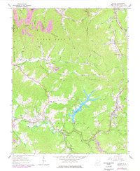
1965 Map of Eccles
USGS Topo · Published 1977About this map
Stephens Lake dominates the central landscape of this Raleigh County quadrangle, its branching shoreline reaching into the valleys between Flat Mountain and Lilly Mountain. In the mid-1960s, the area's development is defined by a dense network of mountain settlements and family cemeteries including Stover Cem and Wiseman Cem. The industrial character of the region is evident in the active Strip Mine operations and the crossing rail lines of the Chesapeake and Ohio RR and the Norfolk and Western RR.
Find a feature on this map
87 named features on this map. Tap any name to fly to it.
Don’t see what you’re looking for? This feature index may not catch every label — zoom into the map to look around manually.
Map Details
Editions of this 1965 Eccles Map
3 editions found
Other maps of this area

1891 · Raleigh
USGS Topo · 1:125,000

1897 · Raleigh
USGS Topo · 1:125,000

1902 · Raleigh
USGS Topo · 1:125,000

1911 · Marshes
USGS Topo · 1:48,000

1911 · Flattop
USGS Topo · 1:48,000

1911 · Beckley
USGS Topo · 1:48,000

1912 · Mullens
USGS Topo · 1:62,500

1913 · Beckley
USGS Topo · 1:62,500

1914 · Eccles
USGS Topo · 1:62,500

1914 · Flattop
USGS Topo · 1:62,500