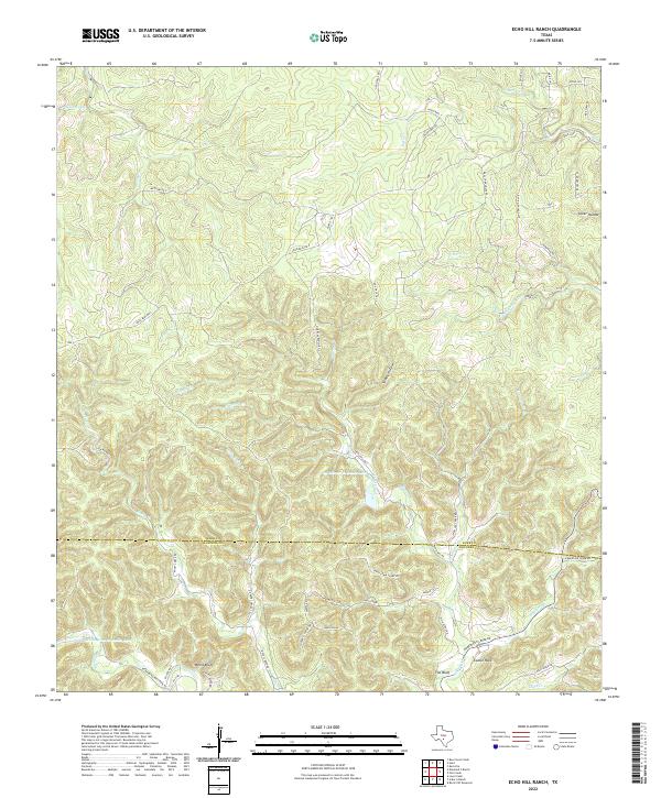
2022 Map of Echo Hill Ranch
USGS Topo · Published 2022About this map
The boundary between Kerr Co and Bandera Co divides this dissected plateau of the Texas Hill Country, characterized by a dense network of seasonal creeks and named hollows. The settlement of White Bluff sits in the southwest, near the headwaters of Brewington Cr and the waters of Brewington Cr Ranch Lake. The topography is defined by prominent natural landmarks like Castle Rock and The Bluff, which rise above the drainage of Robinson Cr. Large ranching properties and private roads dominate the landscape, including the Ed Werner 71 Ranch Lake and tracks such as Aime Real Ranch Rd S. The drainage patterns are intricate, with Bushwhack Cr, Tomas Cr, and Slippery Cr carving deep paths through the limestone terrain, illustrating the hydrologic character of this rural region north of Bandera.
Find a feature on this map
63 named features on this map. Tap any name to fly to it.
Don’t see what you’re looking for? This feature index may not catch every label — zoom into the map to look around manually.
Map Details
Editions of this 2022 Echo Hill Ranch Map
This is the sole edition of this map. No revisions or reprints were ever made.
Other maps of this area

1894 · Kerrville
USGS Topo · 1:125,000

1954 · Llano
USGS Topo · 1:250,000

1954 · San Antonio
USGS Topo · 1:250,000

1955 · Llano
USGS Topo · 1:250,000

1956 · Tuff
USGS Topo · 1:62,500

1956 · Center Point
USGS Topo · 1:62,500

1956 · Llano
USGS Topo · 1:250,000

1957 · San Antonio
USGS Topo · 1:250,000

1964 · Diamond S Ranch
USGS Topo · 1:24,000

1964 · Echo Hill Ranch
USGS Topo · 1:24,000