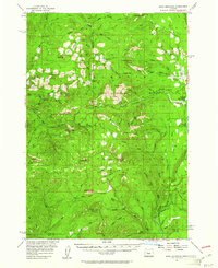
1955 Map of Echo Mountain
USGS Topo · Published 1961About this map
Willamette National Forest defines this high-elevation landscape in the mid-1950s, characterized by a complex network of peaks and drainages. The Middle Fork Santiam River and South Pyramid Creek dominate the northern terrain, carving through the geography near Pyramid and South Pyramid. The map reveals a mid-century reliance on forest management and recreation, evidenced by established sites like House Rock Forest Camp and Fish Lake Forest Camp. High points such as Echo Mtn, Iron Mtn, and the Twin Buttes provide vertical context to the numerous creeks including Huckleman Creek and Ikenick Creek. Distinctive clearings and meadows, such as Tombstone Prairie, Lost Prairie, and Wolf Meadow, suggest breaks in the heavy timber that served as local landmarks for travelers and foresters. The survey also captures the boundary between Linn and Lane counties in the southern reaches, near Wolf Rock and the lookout at Carpenter Mtn.
Find a feature on this map
80 named features on this map. Tap any name to fly to it.
Don’t see what you’re looking for? This feature index may not catch every label — zoom into the map to look around manually.
Map Details
Editions of this 1955 Echo Mountain Map
3 editions found

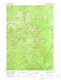
Other maps of this area

1927 · Mt. Jefferson
USGS Topo · 1:125,000

1929 · Mill City
USGS Topo · 1:125,000

1929 · Three Sisters
USGS Topo · 1:125,000

1930 · Mt. Jefferson
USGS Topo · 1:125,000

1932 · Three Sisters
USGS Topo · 1:125,000

1934 · Mc Kenzie Bridge
USGS Topo · 1:96,000

1940 · Mc Kenzie Bridge
USGS Topo · 1:125,000

1953 · Salem
USGS Topo · 1:250,000

1954 · Salem
USGS Topo · 1:250,000

1955 · Blue River
USGS Topo · 1:62,500