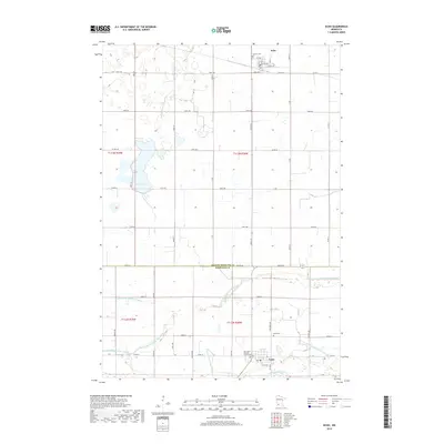
2019 Map of Echo
USGS Topo · Published 2019About this map
The agricultural landscape of the Minnesota River Valley comes into focus through this 2019 survey of the border between Yellow Medicine and Redwood counties. Centered on the prairie settlements of Echo and Vesta, the map illustrates a highly organized drainage system essential to the region's farming economy. A network of numbered water management features, including County Ditch Number Ninetytwo and Judicial Ditch Number Thirtythree, crisscrosses the township lines, supplementing natural water bodies like Curtis Lake and the Redwood River. Local genealogy and land use patterns are anchored by sites such as the German Cem and the Holy Name Catholic Church Cem, providing specific points of interest for those tracing family history in these rural townships. The map's grid of section roads and county highways reflects the enduring structure of the Public Land Survey System in this part of the Midwest.
Find a feature on this map
45 named features on this map. Tap any name to fly to it.
Don’t see what you’re looking for? This feature index may not catch every label — zoom into the map to look around manually.
Map Details
Editions of this 2019 Echo Map
This is the sole edition of this map. No revisions or reprints were ever made.
Other maps of this area

1953 · New Ulm
USGS Topo · 1:250,000

1957 · New Ulm
USGS Topo · 1:250,000

1958 · New Ulm
USGS Topo · 1:250,000

1962 · School Grove Lake
USGS Topo · 1:24,000

1962 · Wood Lake
USGS Topo · 1:24,000

1962 · Milroy
USGS Topo · 1:24,000

1965 · Echo
USGS Topo · 1:24,000

1965 · Lone Tree Lake
USGS Topo · 1:24,000

1965 · Belview
USGS Topo · 1:24,000

1965 · Iverson Lake
USGS Topo · 1:24,000