2022 Map of Echo
USGS Topo · Published 2022About this map
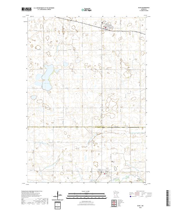
Echo and Vesta anchor this southwestern Minnesota agricultural landscape at the border of Yellow Medicine and Redwood Counties. The terrain is defined by a sophisticated water management network, where natural features like Curtis Lake and Boiling Spring Cr have been integrated into a system of man-made drainage, including Judicial Ditch Number Thirtyseven and County Ditch Number Ninetytwo. The southern edge of the quadrangle is marked by the winding course of the Redwood River, which is paralleled by the Redwood River Trl. This survey captures the rural character of the region, documenting vital community landmarks such as the Holy Name Catholic Church, German Cem, and Vesta Cem, reflecting the area's ancestral settlement patterns and enduring agricultural heritage.
Find a feature on this map
39 named features on this map. Tap any name to fly to it.
Don’t see what you’re looking for? This feature index may not catch every label — zoom into the map to look around manually.
Map Details
Editions of this 2022 Echo Map
This is the sole edition of this map. No revisions or reprints were ever made.