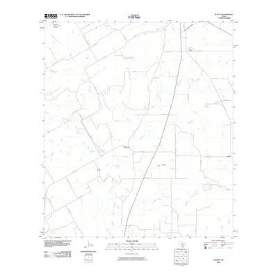
2010 Map of Ecleto
USGS Topo · Published 2010About this map
Harmony and Ecleto anchor this landscape of south-central Texas, where the drainage of the Ecleto Creek basin defines the local geography. The area's economic activity is evidenced by the Person Oil Field, while the rural character is maintained through a network of farm-to-market roads like FM 627 RD and FM 887. Water management is prominent in the northern reach, featuring Korth Lake and the uniquely named Texas No Name Number 18 Dam.
Find a feature on this map
46 named features on this map. Tap any name to fly to it.
Don’t see what you’re looking for? This feature index may not catch every label — zoom into the map to look around manually.
Map Details
Editions of this 2010 Ecleto Map
This is the sole edition of this map. No revisions or reprints were ever made.
Other maps of this area

1920 · Smiley
USGS Topo · 1:125,000

1953 · Beeville
USGS Topo · 1:250,000

1953 · Seguin
USGS Topo · 1:250,000

1956 · Beeville
USGS Topo · 1:250,000

1956 · Karnes City
USGS Topo · 1:62,500

1958 · Seguin
USGS Topo · 1:250,000

1960 · Beeville
USGS Topo · 1:250,000
1960 · Karnes City
USGS Topo · 1:24,000

1960 · Kosciusko
USGS Topo · 1:24,000

1960 · Helena
USGS Topo · 1:24,000