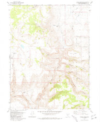
1981 Map of Eddies Garden
USGS Topo · Published 1981About this map
The Buffalo Hills dominate this high-desert landscape in northwestern Nevada, defined by a complex network of intermittent water sources and high-altitude rangeland features. Early ranching and grazing infrastructure is evident through named locations such as Stone Corral and Norton Place, alongside established seasonal camps like Pauls Camp. The hydrography is centered on the drainage systems of the North Fork Buffalo Creek and Middle Fork Buffalo Creek, which are fed by numerous named seeps including Wildcat Spring and Wrangler Springs. This 1981 record captures the layout of the high meadows before modern landscape changes, showing the placement of the Stockade and the southern Buffalo Meadows, areas historically significant for livestock management in the Great Basin.
Find a feature on this map
29 named features on this map. Tap any name to fly to it.
Don’t see what you’re looking for? This feature index may not catch every label — zoom into the map to look around manually.
Map Details
Editions of this 1981 Eddies Garden Map
This is the sole edition of this map. No revisions or reprints were ever made.
Other maps of this area

1886 · Granite Range
USGS Topo · 1:250,000

1894 · Granite Range
USGS Topo · 1:250,000

1955 · Lovelock
USGS Topo · 1:250,000

1959 · Lovelock
USGS Topo · 1:250,000
1980 · Buffalo Creek
USGS Topo · 1:24,000
1980 · Burnt Lake
USGS Topo · 1:24,000
1980 · Mixie Flat
USGS Topo · 1:24,000
1980 · Hole In The Ground
USGS Topo · 1:24,000

1981 · Gerlach
USGS Topo · 1:100,000
1981 · Poodle Mtn
USGS Topo · 1:24,000