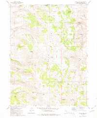
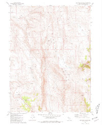
1981 Map of Poodle Mtn
USGS Topo · Published 1981About this map
The Buffalo Hills dominate this high desert landscape, characterized by a complex network of seasonal drainages and essential water sources. As recorded in the mid-1970s and published in 1981, the area is defined by its canyons, including Pauls Camp Canyon, Tin Canyon, and Wrangler Canyon, which converge toward the central plateau of Boulder Flat. The presence of small-scale infrastructure like Boulder Dam and several reservoirs, such as Buffalo Hills Reservoir No 8, points to the vital management of water for livestock in this arid environment.
Find a feature on this map
40 named features on this map. Tap any name to fly to it.
Don’t see what you’re looking for? This feature index may not catch every label — zoom into the map to look around manually.
Map Details
Editions of this 1981 Poodle Mtn Map
This is the sole edition of this map. No revisions or reprints were ever made.
Other maps of this area

1886 · Granite Range
USGS Topo · 1:250,000

1894 · Granite Range
USGS Topo · 1:250,000

1955 · Lovelock
USGS Topo · 1:250,000

1959 · Lovelock
USGS Topo · 1:250,000
1980 · Buffalo Creek
USGS Topo · 1:24,000

1980 · Wall Spring
USGS Topo · 1:24,000
1981 · Eddies Garden
USGS Topo · 1:24,000
1981 · Squaw Valley
USGS Topo · 1:24,000
1981 · Crutcher Canyon
USGS Topo · 1:24,000

1981 · Gerlach
USGS Topo · 1:100,000