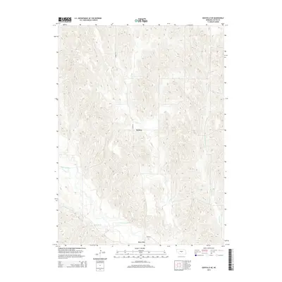
2014 Map of Eddyville NE
USGS Topo · Published 2014About this map
South Loup River bottomlands define the southern reaches of this landscape in Custer County, where the river valley creates a break in the dissected hills of central Nebraska. This 2014 survey documents the small settlements of Buckeye and Burr Oak, providing a record of the rural community structure and agricultural infrastructure in the early 21st century. The map traces the winding courses of several tributaries, including Deer Cr and W Box Elder Cr, which have carved intricate drainage patterns into the loess hills. Local transit and property boundaries are marked by the section-line placement of Sumner Rd and Cumro Rd, reflecting the enduring influence of the Public Land Survey System on the Nebraska prairie. This topographic study captures the relationship between the upland grazing land and the fertile, well-watered soils near Burr Oak Cr.
Find a feature on this map
8 named features on this map. Tap any name to fly to it.
Don’t see what you’re looking for? This feature index may not catch every label — zoom into the map to look around manually.
Map Details
Editions of this 2014 Eddyville NE Map
This is the sole edition of this map. No revisions or reprints were ever made.
Other maps of this area

1951 · Broken Bow SW
USGS Topo · 1:24,000

1951 · Ansley
USGS Topo · 1:24,000

1951 · Broken Bow SE
USGS Topo · 1:24,000

1951 · Eddyville NE
USGS Topo · 1:24,000

1951 · Mason City SW
USGS Topo · 1:24,000

1951 · Eddyville NW
USGS Topo · 1:24,000

1951 · Eddyville
USGS Topo · 1:24,000

1951 · Mason City NW
USGS Topo · 1:24,000

1951 · Eddyville SW
USGS Topo · 1:24,000

1955 · Broken Bow
USGS Topo · 1:250,000