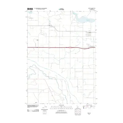
2010 Map of Eden
USGS Topo · Published 2010About this map
The irrigated landscapes of Jerome County are defined here by a dense grid of water distribution, where the Snake River winds across the southern portion of the map. This area is anchored by the rural settlements of Eden and Hazelton, both situated along a corridor of early 21st-century infrastructure. The region's agricultural dependency is visible through the intricate system of the Twin Falls Main Canal, C Canal, and A Canal, which transform the arid plains into productive farmland. North of the primary settlements, Wilson Lake Reservoir and Goose Lake stand out as significant water bodies in this man-made hydrological network.
Find a feature on this map
44 named features on this map. Tap any name to fly to it.
Don’t see what you’re looking for? This feature index may not catch every label — zoom into the map to look around manually.
Map Details
Editions of this 2010 Eden Map
This is the sole edition of this map. No revisions or reprints were ever made.
Other maps of this area

1955 · Twin Falls
USGS Topo · 1:250,000

1958 · Twin Falls
USGS Topo · 1:250,000

1964 · Kimberly
USGS Topo · 1:24,000

1964 · Eden
USGS Topo · 1:24,000

1964 · Milner
USGS Topo · 1:24,000

1964 · Hazelton NE
USGS Topo · 1:24,000

1964 · Perrine
USGS Topo · 1:24,000

1964 · Hunt
USGS Topo · 1:24,000

1965 · Milner Butte
USGS Topo · 1:24,000

1965 · Stricker Butte
USGS Topo · 1:24,000