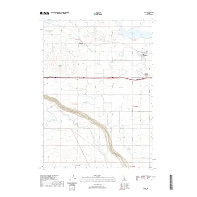
2020 Map of Eden
USGS Topo · Published 2020About this map
Agricultural development and water management define this portion of the Magic Valley at the start of the 2020s. The small centers of Eden and Hazelton serve as the primary hubs for a landscape crisscrossed by an extensive network of irrigation infrastructure. Vital water sources and distribution channels, including the Twin Falls Main Canal, Wilson Lake Reservoir, and the Snake River, demonstrate the complexity of high-desert farming. The topography is largely governed by these man-made waterways like Goose Lake Drain and Lateral C-50, though natural features like Skeleton Butte provide distinct landmarks amidst the grid of country roads. Near the eastern edge, the Hazelton Municipal Airport and the local road network, including Railroad Street and Main Street, reflect the area's role as a regional transit and trade point within Jerome and Twin Falls Counties.
Find a feature on this map
79 named features on this map. Tap any name to fly to it.
Don’t see what you’re looking for? This feature index may not catch every label — zoom into the map to look around manually.
Map Details
Editions of this 2020 Eden Map
This is the sole edition of this map. No revisions or reprints were ever made.
Other maps of this area

1955 · Twin Falls
USGS Topo · 1:250,000

1958 · Twin Falls
USGS Topo · 1:250,000

1964 · Kimberly
USGS Topo · 1:24,000

1964 · Eden
USGS Topo · 1:24,000

1964 · Milner
USGS Topo · 1:24,000

1964 · Hazelton NE
USGS Topo · 1:24,000

1964 · Perrine
USGS Topo · 1:24,000

1964 · Hunt
USGS Topo · 1:24,000

1965 · Milner Butte
USGS Topo · 1:24,000

1965 · Stricker Butte
USGS Topo · 1:24,000