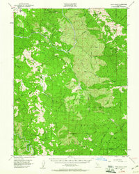
1952 Map of Eden Valley
USGS Topo · Published 1961About this map
Middle Fork Eel River carves a deep path through this mid-century landscape in Mendocino National Forest, where isolated cattle operations and rugged ridgelines define the terrain. The presence of Eden Valley Ranch and Elk Creek Ranch illustrates the large-scale ranching that occupied these interior valleys long after the initial settlement period. This 1952 field survey captures a transition point in the northern California backcountry, mapping the intricate drainage systems of Eden Creek and Thatcher Creek alongside early landmarks like Four Pines (Site). High-altitude features such as Mt Sanhedrin and Bald Mtn dominate the southern portion of the sheet, overlooking pockets of water like Lily Pad Lake and Brushy Lake. The map serves as a vital record for tracing old trails and ranching boundaries in the difficult terrain between Round Valley and the Forks of Eel.
Find a feature on this map
71 named features on this map. Tap any name to fly to it.
Don’t see what you’re looking for? This feature index may not catch every label — zoom into the map to look around manually.
Map Details
Editions of this 1952 Eden Valley Map
4 editions found

Other maps of this area

1920 · Covelo
USGS Topo · 1:62,500

1922 · Willits
USGS Topo · 1:62,500

1922 · Hullville
USGS Topo · 1:62,500

1926 · Covelo
USGS Topo · 1:62,500

1929 · Eden Valley
USGS Topo · 1:62,500

1942 · Willits
USGS Topo · 1:62,500

1943 · Pomo
USGS Topo · 1:62,500

1944 · Willits
USGS Topo · 1:62,500

1951 · Lake Pillsbury
USGS Topo · 1:62,500

1951 · Laytonville
USGS Topo · 1:62,500